


interview from A&B issue 10|2022
A city is like an organism, and its health is determined by many complex processes and planning tools. Do the methods currently being used work? Do they keep up with the needs of residents and changes in the world? Let's take a look at them!
Let's start with what spatial governance is. According to the Law on Spatial Planning and Development, it is "such shaping of space that creates a harmonious whole and takes into account in orderly relations all functional, socio-economic, environmental, cultural and compositional and aesthetic conditions and requirements." Surprisingly, the concept was defined only in the 2003 law - at the dawn of the 21st century, a term that has been used by urban planners for decades was finally bent.
Contrary to the first connotation, spatial order is not at all a consideration in spatial order. Spatial planning and development takes into account (in addition to architectural, urban and landscape values), first of all, such issues as requirements for the protection of the environment and cultural heritage and monuments, as well as modern cultural assets. In addition, the essence of spatial order is to reconcile the needs of state defense and security and the public interest, as well as the needs of people with disabilities. The law also mentions the economic value of a given space, property rights and the development of technical infrastructure.
Conducting spatial policy, including the adoption of, among other things, a study of the conditions and directions of spatial development, is one of the municipality's own tasks. These tasks also include the enactment of local spatial development plans, which are binding only on the municipality's territory. This is a legal act that consists of a descriptive and a graphic part. The graphic form of the plan is a sketch that is a faithful reflection of the actual layout of streets, buildings, along with a detailed legend. MPZP regulates such issues as the use of a given area, the conditions of its development, the type of development, guidelines for the location of the building on the property and its height, or the location of public purpose investments.

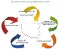
The main features of Polish space 2030, from the document Concept of Spatial Development of the Country 2030
© Concept for Spatial Development of the Country 2030
A local spatial development plan is often confused with a study of land use conditions and directions. The difference is that a study is not an act of local law and administrative decisions cannot be issued on its basis. The principles included in the study must be in accordance with the current arrangements for the spatial development of the province, so it is a kind of prelude to the creation of a local spatial development plan. If an MPZP for a given area does not yet exist (and there are still many such spots on the map of Poland), the determination of the ways of development and conditions for the development of the land is carried out by means of a decision on the conditions of development and land use.
The local authority is obliged to announce that a local plan has been prepared, and residents have the right to submit comments on it. Anyone wishing to do so may submit an application to the draft within at least twenty-one days of the announcement. Then the draft local plan is drawn up, theoretically taking into account the applications submitted by residents. The date of the project's public inspection is announced a week in advance, then it can be viewed for at least twenty-one days. After that, you can join a public discussion organized by the authority. The key to reading the plan correctly is to understand the symbols and colors placed in the legend. It is difficult for a layman to analyze the entire study prepared by people proficient in the subject, so, despite the possibility of intervention, not all interested parties give their input at the stage of the plan's formation. Why is it worth taking an interest in this issue? For example, because as owners of a property we have the right to develop it in any way we want, but within the limits of current regulations, so it is worthwhile to influence them in advance. Ready-made LSDPs are usually made available online, for example, on the pages of Public Information Bulletins or the government's Geoportal. Anyone can access them for an overview. To be able to take any action, one must obtain a paper excerpt or extract from the map available at the municipality or city department responsible for urban planning issues.

Nowe Żerniki - conceptual view of the WuWA2 model housing development in Wroclaw
© Nowe Żerniki
The basic criterion of utility of tools is their effectiveness. An increasingly common problem is the inconsistency of a once-established spatial plan with actual, ever-changing needs. Strategic goals themselves at the local level are rapidly becoming obsolete. The current state of planning is perceived as unsatisfactory by both the local government and social sides, as well as by investors. The search for new spatial policy tools is a growing subject of discussion not only in our country. The problem of unification of planning systems in Europe and the need to make spatial planning more effective, while ensuring the conditions for development, is one of the most important challenges of modern European urban planning. It can be a trap to over-involve and push politicians to deal with this topic - the consequence of evaluating planning in terms of politics can be to treat spatial strategy as the domain of politicians and populists.
The condition for the smooth functioning of the spatial planning system, capable of resolving conflicts and achieving overall planning goals, is the active participation of all groups of participants in planning processes and procedures. Restricting the activity of any of the groups thus narrows the fields of interaction and the ability to achieve overall goals, and such a system is an unsustainable system, lacking objectivity. At the same time, each group (for example, the local community, individuals active in the economy, climate advocates) may have different goals, sometimes conflicting ones. A larger number of participants thus means greater dispersion and a number of goals, different for each group. This begs the question, to what extent are the various spatial planning tools useful for achieving the set, especially long-term goals? The goals in question are, for example, rationalization of the use of environmental resources, creation of conditions for economic development, protection of landscape values or, of course, aiming to achieve spatial order. All this can be called the protection of the public interest in the broadest sense.
Municipalities that have long had a local zoning plan, that is, have responded quickly to this need, have now fallen behind. Why? These oldest plans in many cases were still made by hand, and are accused of errors that are not easy to correct, and inaccuracy. For example, a line one millimeter thick on a plan at a scale of 1:5000 corresponds to five meters in reality. For a single plot or building, such a margin of error is a lot. Digitization and a fresh look at the details are essential here. Besides, previously there were no uniform standards defining the rules for creating digital planning data. Older plans, even if computer-generated, were produced using outdated software. Heterogeneous nomenclature, symbols in the legend or difficult comparison of data from different sources are factors that affect the efficiency of spatial analysis. Digitization is also supposed to speed up processes, since changes can be made on the fly in the electronic version, working on editable files. Unfortunately, this does not change the fact that the document sometimes has to go to dozens of different authorities for approval. This makes it impossible to respond quickly to needs.
At the end of 2011, the Council of Ministers adopted the document Concept for Spatial Management of the Country 2030, issued by the Ministry of Regional Development. What is this document? As you can read in the introduction, "The document presents a vision of the country's spatial development in the perspective of the next twenty years, defines the objectives and directions of the country's development policy for its realization, and indicates the principles and mechanisms of coordination and implementation of public development policies with significant territorial impact. Thus, the NAP 2030 has many characteristics of a general development strategy, combining elements of spatial development with factors of socio-economic development. The new approach to the issue of the country's spatial development proposed in the NAP 2030 is to change the approach to the role of the state's spatial policy in achieving the outlined development visions. The NSPCC 2030 proposes to break with the previous dichotomy of spatial and socio-economic planning at the national, provincial and local levels and with regard to functional areas, introduces the interdependence of spatial policy objectives with regional policy objectives, links strategic planning with theprogramming of activities within the framework of development programs and operational programs co-financed from EU funds, determines the state's actions in the legislative and institutional sphere for strengthening the efficiency of the spatial planning system and development activities (including investment) oriented territorially. The NAP 2030 also brings the maritime zone, hitherto absent from national-level strategic documents, into the mainstream of national spatial planning considerations, and expands the scope of cross-border interactions in the land and maritime system."
In the words of the introduction, the then Minister of Regional Development (2007-2013), Elżbieta Bieńkowska, writes that: "the concept stands out from previous documents of this type in two important respects - first, it combines spatial planning with socio-economic planning, giving specific references in this regard, and second, it formulates postulates in order to restore spatial order in Poland and improve the system of planning and spatial development. The Concept for Spatial Management of the Country 2030 defines the spatial policy of our country in the perspective of the next twenty years. The document is a response to current and future challenges - including economic, demographic, climate or infrastructure challenges facing Poland."
This all sounds great, but reading this document as we near the end of this twenty-year period rather than the beginning, it's time to ask ourselves some questions. What about the fight against environmental disaster? What about the felling of the Bialowieza Forest and the cross-cutting of the Vistula Spit? What about the housing problems? What about spatial chaos? What about the "revitalizations" of markets in cities and towns, turning them into concrete deserts? The problems are not diminishing, in fact they seem to be growing, and it is difficult to find tangible results of the creation of the NAP.
As part of the International Architecture Biennale Krakow 2021, there was an interesting series of short films prepared by the Małopolska Regional Chamber of Architects of Poland. In it, invited experts spoke on such topics as spatial planning tools, revitalization of space, principles of development of urban structures or the role of space in shaping social attitudes.
Dr. Agnieszka Damasiewicz answered the question of whether effective regulations for efficient spatial management are possible. Damasiewicz said that effective regulation for spatial planning is possible, and it does not require an amendment to the Spatial Planning Law. In her opinion, between the legal mechanism, which is the law, and the administrative mechanism, which is the planning procedure, there is a lack of participation by architects to help urban planners see their point of view and the level of detail that concerns them. Urban planners usually go to the Technical Conditions and the definitions and regulations contained therein. Architectural projects require absolute application of the notation and treat it as a ready-made instruction, and at the stage of developing the whole (urban planning) it is impossible to anticipate every detail (architecture). The gap between the existence of the procedure and the possibility of its application is cited as another obstacle. Among other things, this refers to a situation in which plans are lectured in accordance with the procedure and residents have the opportunity to get acquainted with them, but the text or drawing presented is not understandable to them. There is a lack of inclusion in the whole process of a human liaison who will translate specialized language into language understandable to those who take part in public consultations, to interested parties who are not specialists. The problems mentioned above provide an answer to the question of why the administrative procedure is ineffective.


