





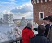


from the series "Software, tools for the architect - trends 2026"
In recent years, digital tools that support the preservation and revitalization of historic buildings have become increasingly important. One such example is ZWCAD, which, thanks to its functionality, has become a key tool in the Wawel Royal Castle inventory and documentation project. The following article will look at how existing traditional work methods are being supported by the latest digital technologies.
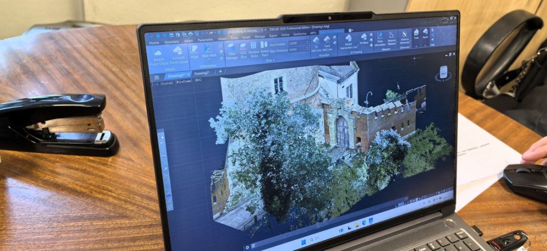
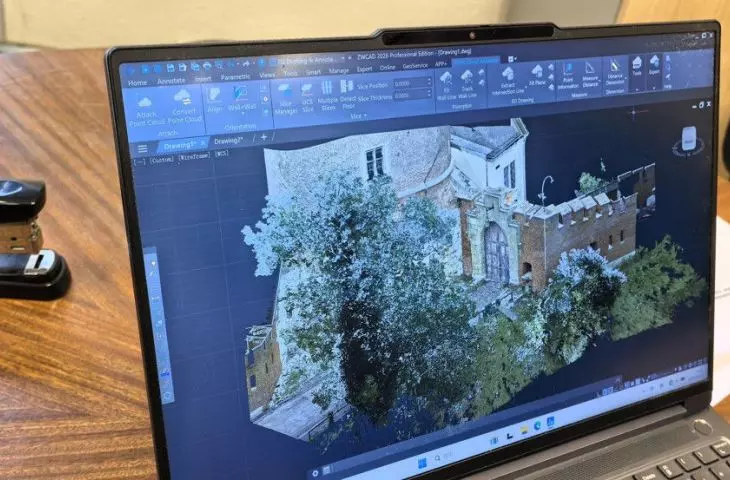
3D inventory - object scan as point cloud in ZWCAD
© ZWCAD
Wawel Royal Castle - conservation challenges
Since the beginning of the 20th century, the Royal Castle has undergone a complex restoration process - from removing damage caused by warfare, to restoring original details, to modernizing adaptations in line with the requirements of modern heritage conservation. Architectural research has been carried out systematically since the 19th century. A comprehensive research and preservation program continues, including archaeological work and advanced technical documentation.
Such an elaborate and historically valuable site requires not only traditional preservation expertise, but also modern tools for recording changes, analyzing the state of preservation and accurately planning restoration.
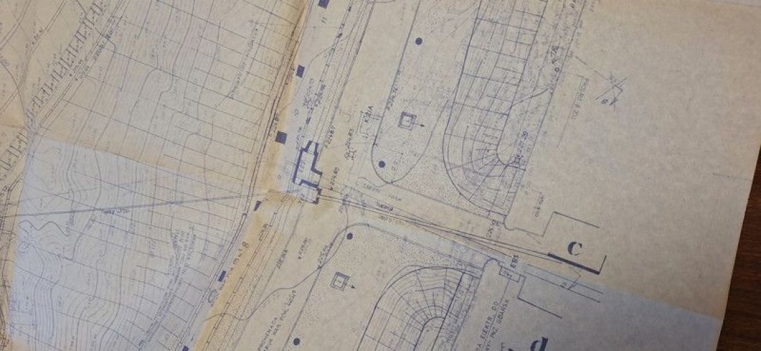
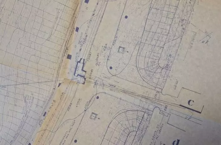
Original paper technical documentation of the site
© ZWCAD
Digital inventory as the foundation of historic preservation
What does digital inventory mean?
Architectural inventory is the process of creating detailed documentation of all building elements - structural, decorative and technical. In the case of monuments such as the Wawel Castle, it is not only recording dimensions, but also analyzing preserved details, identifying various materials, finding historical layers and restoring the original condition.
Digital inventory means that modern techniques are used to collect and analyze data - such as:
-
3D laser scanning and point clouds,
-
high-resolution photogrammetry,
-
GIS and spatial analysis systems,
-
3D digital models and orthophotos.
The data acquired in this way is huge, complex and often difficult to process with traditional CAD methods. This is where a tool like ZWCAD comes in, offering comprehensive handling of these data sets and their integration into digital project documentation.
The role of point clouds and spatial analysis
A point cloud is a kind of "digital photograph" of an object with accuracy down to the millimeter. It represents a collection of millions of points in three-dimensional space that reflects the shape and details of an object - in this case, elements of the Royal Castle. Using laser scanners (LiDAR) and photogrammetry techniques, huge sets of data are acquired, which then need to be processed.
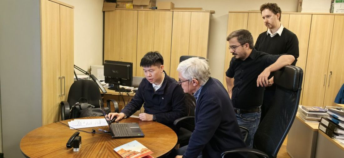
A presentation of the capabilities of Point Cloud Assistant - an application for working on point clouds in ZWCAD
© ZWCAD
ZWCAD, equipped with Point Cloud Assistant (PCA) features, allows you to:
-
import and display point clouds in the CAD environment,
-
quick UCS assignment of a cloud
-
sections, multiple sections
-
drawing of floor plans
-
creation of precise 2D drawings on the basis of 3D data
-
analysis of plane deviations
This allows architects and conservators to not only see "raw" data, but to transform it into useful technical drawings and elements of project documentation.
ZWCAD in the Royal Castle inventory project - a detailed case study
How is ZWCAD being used at the Royal Castle?
The Wawel Royal Castle is using ZWCAD software in a project to inventory historic buildings within the Wawel Hill. This process is part of the preparation for restoration and conservation work. Data for the inventory is provided by specialized third-party companies, which carry out scans of the objects using LiDAR technology and photogrammetry. The result of these activities is a point cloud - a huge collection of spatial data, which is then imported into ZWCAD and processed there.
In the ZWCAD environment, the point cloud is not only viewed, but also analyzed and edited - which facilitates the creation of precise technical drawings, the planning of renovation work and the preparation of execution documents.
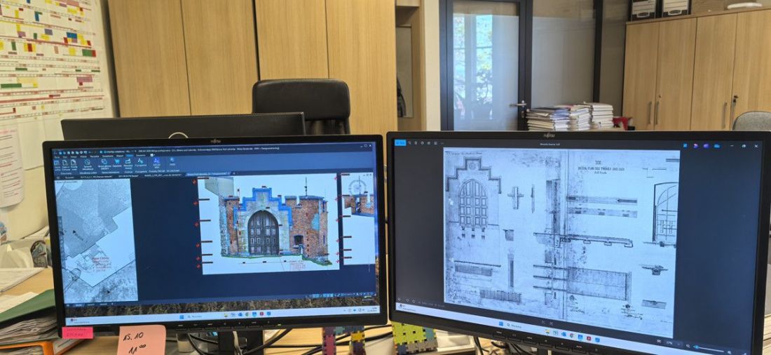
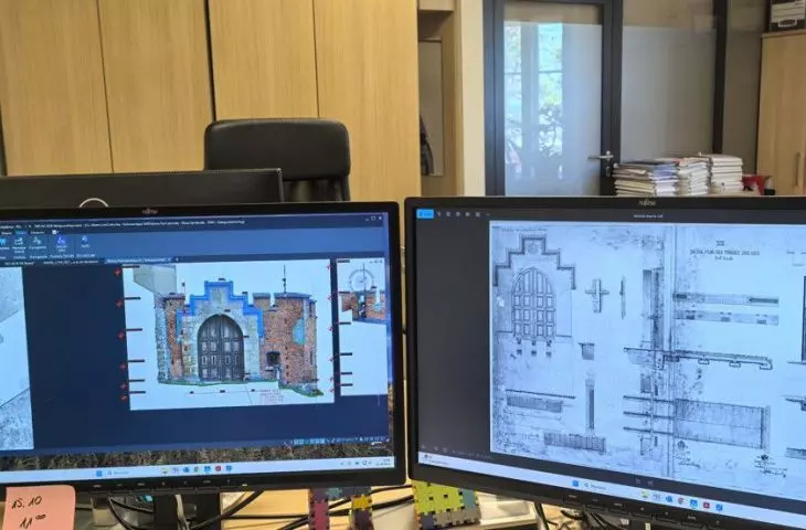
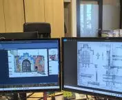
Right - Scan of technical documentation from 1887 showing the gate at the Little Tower. Left - Contemporary inventory of the same object in ZWCAD - outline photogrammetry extracted from the point cloud.
© ZWCAD
Examples of inventory elements: the gate at the Small Tower and the attic
During one of the presentations given by the ZWSOFT team, the specialists had the opportunity to show the realizations made in ZWCAD for the elements of the Royal Castle - including: the preparation of the renovation of the Gate at the Small Tower and the effect of the renovation of the helms of the attic.
Here you can see the practical application of tools such as:
-
3D point cloud data display,
-
extraction of lines and surfaces into vector drawings,
-
creation of 2D drawings and architectural details with high accuracy.
As a result, design work and preparation for renovation can be carried out more efficiently, faster and with greater precision than when using only traditional measurement methods.
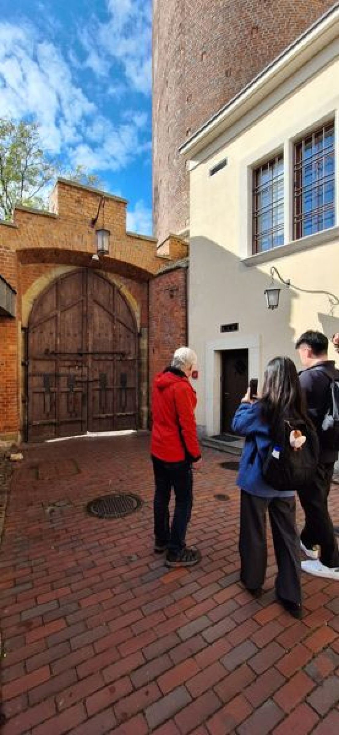
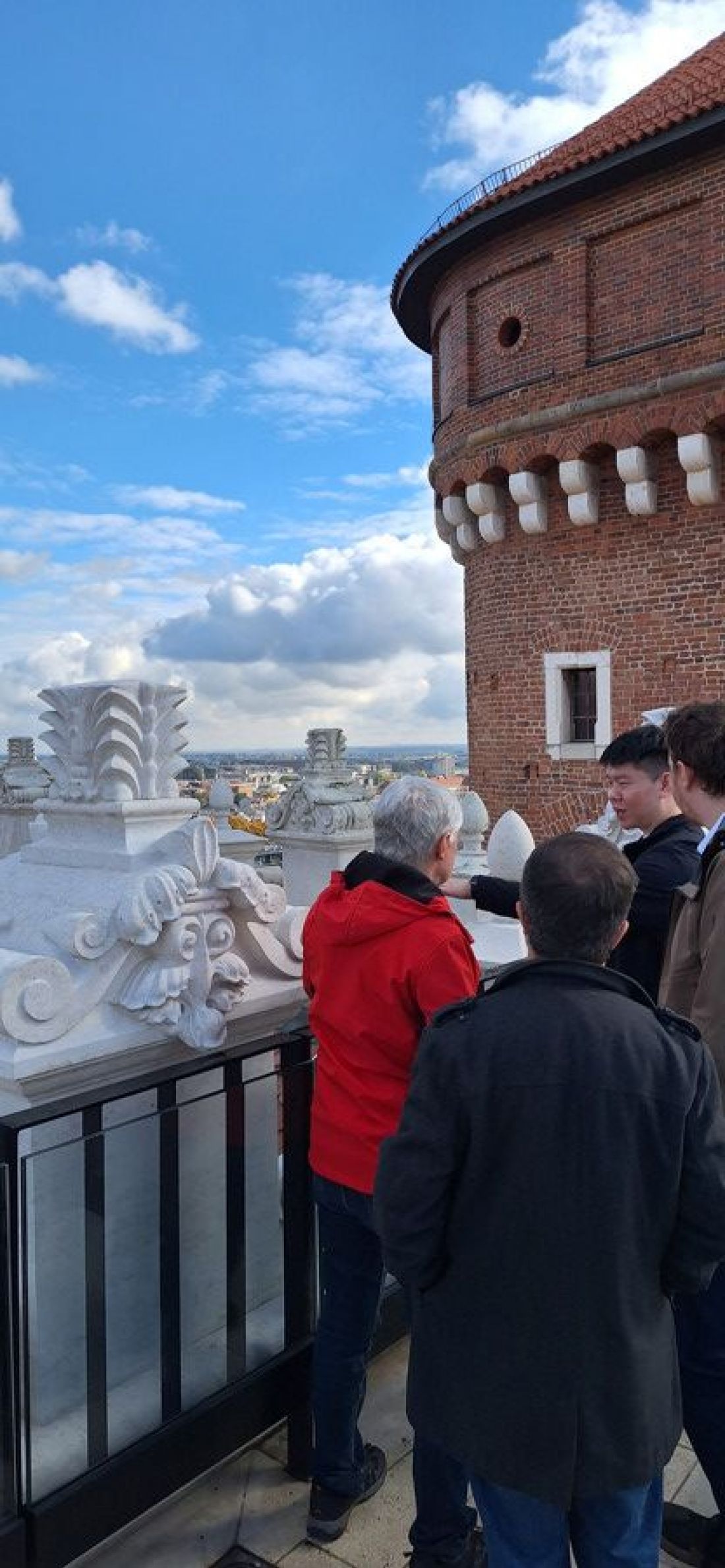
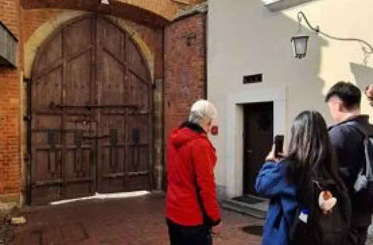
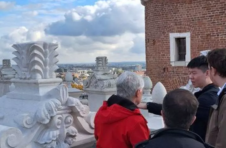
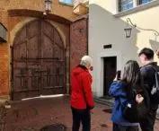
Left: The gate at the Little Tower - an object planned for renovation, Right: The effect of renovation activities of the attic's helm
© ZWCAD
Integration of historical and contemporary scans
Often, project documentation requires combining information from different sources - such as:
-
scans of historical architectural drawings,
-
data from modern 3D measurements,
-
photographs and maps,
-
archival descriptions.
ZWCAD, in conjunction with tools such as ZWVectorization, allows you to convert scanned images, maps and analog materials into editable vectors, while maintaining high quality and precision.
This means that even historical maps or drawings, often lacking modern technical precision, can be an integral part of design documentation.
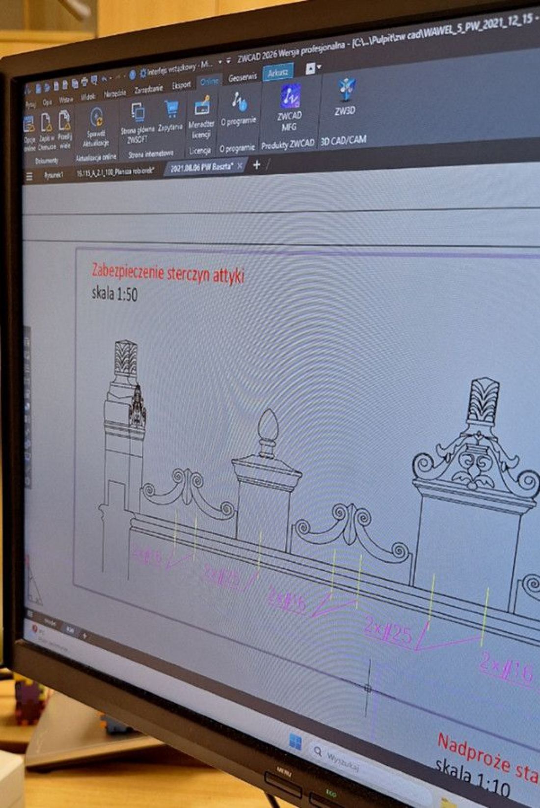
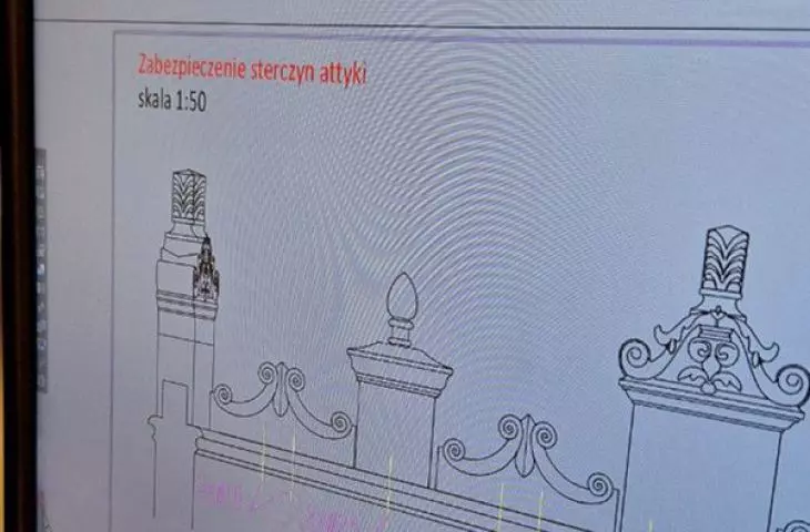
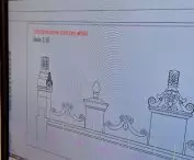
Technical documentation in ZWCAD showing a project for the renovation of attic rudders.
© ZWCAD
The importance of CAD tools in the care of historic buildings
The role of tools such as ZWCAD is not limited to documentation and drawing. With the ability to analyze point clouds and create 3D models, engineers and conservators can:
-
compare the current state of an object with historical data,
-
detect deviations from the original condition,
-
identify areas with special structural problems,
-
plan restoration work with millimeter-level accuracy.
These are applications that significantly increase the quality of the design process and minimize the risk of execution errors.
Impact of digital tools on the restoration process
Modern digital tools, led by CAD solutions, are changing the way we approach the preservation of architectural heritage.
Thanks to them:
-
design work is more precise,
-
analysis and documentation time shorter,
-
cooperation between project teams easier,
-
the risk of execution errors lower,
-
historical data can be integrated with modern CAD models.
Summary - modern CAD tools in the service of heritage preservation
The case study of the use of ZWCAD in the Wawel Royal Castle inventory project shows how design tools, which until recently were used mainly for drawing and technical documentation, are gaining a new role in the protection and conservation of historical monuments.
By combining point clouds, vectorization tools, 3D data analysis and advanced vector editing in a single CAD environment, ZWCAD becomes not just a design tool, but a platform for integrating historical and contemporary data into a single design process - which is especially important in high-complexity tasks such as the restoration of the Royal Castle.
This project is an example of how innovative technology can support traditional fields of expertise - combining historic preservation, architecture, engineering and modern digital tools.
ZWCAD - discount for Readers
For A&B readers interested in purchasing ZWCAD, we have prepared a discount code of 5% to the store: programcad.net
In the shopping cart add: AB2026
For more information, visit the company's Usługi Informatyczne „SZANSA” Sp. z o.o. page on the PdA portal and the website of Usługi Informatyczne "SZANSA" Sp. z o.o.